This is a guest blog post written by the team at Penang Hills Watch (PHW), an initiative by the Penang Forum (PF).
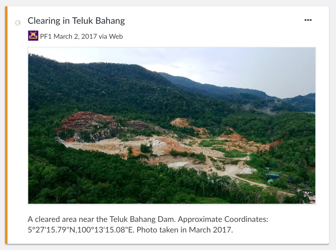
Penang Hills Watch (PHW) is an initiative by the Penang Forum (PF), a coalition of NGOs and individuals, to keep tabs on activities affecting Penang's hills. Penang is a highly urbanized and densely populated state in the northern region of Malaysia. Years of human activity has reduced its forests to just 7.4 % of its land area, located mainly in the hills. These forested hills function as water catchments to provide water supply, prevent soil erosion and landslides, and are the green lungs for nature appreciation and outdoor recreation. However, they are also fragile and easily degraded when disrupted by human activities. Increasingly, housing development and hill farming activities have been expanding into the hilly land, jeopardizing whatever little natural habitat that remains.
Having received reports from the public about hill clearing activities on an occasional basis, Penang Forum saw the need to collate and map such information to provide a comprehensive picture of the extent of hill clearing in Penang and gauge its impact. The objective of this PHW initiative is to involve the public in reporting cases of hill clearing, enhancing public awareness and foster cooperation between civil society and the state government in addressing this issue. Hikers, NGOs, Resident's Associations and the press would be the sources of our information on hill clearing activities.
In searching for a public domain platform to interactively map and document cases of hill clearing activity we found Ushahidi suited for our needs and is simple to use. We started experimenting with the Ushahidi platform in July 2016 and received useful support from the Ushahidi team, particularly in using the newly available feature then of including photos tagged to mapped locations - an important feature for our purpose besides the ability to annotate and categorize the mapped items. Our current Penang Hills Watch (PHW) deployment was launched on the 31st of October 2016 with a press conference and wide coverage in the local media.
According to PF member Rexy Prakash Chacko, making a report on observed hill clearing activities just involves the observer taking a photo of the activity using a smart phone and sending it via WhatsApp with its GPS location with a brief written description, to the PHW hotline at +60 11 51274277. Reports can also be channeled via the Penang Hills Watch Facebook Page. The gate keepers of the PHW deployment then verify this information before tagging these on the PHW deployment.
Thus far a total of 138 cases have been tracked and mapped. 86 cases were shared to us by the state government while the other 52 cases were tracked from reports made by concerned citizens. A visitor to the deployment would be able to see pin points on the interactive map indicating sites of hill clearing activity.

The citizen's reports thus recorded are shared with the relevant state government agencies, which PHW would schedule to meet on a regular basis to identify appropriate actions and discuss mitigation efforts on a case by case basis. Rexy said that the response from the state has been good. Several of the cases tracked on the PHW deployment have been identified as illegal clearing activities and the state government is proactively taking action against the responsible parties and to mitigate the damage. We are currently submitting reports of citizens’ observations to the state on a quarterly basis based on what have been tracked on the PHW deployment. This simple deployment has stimulated much discussion about hill conservation and protection in Penang. It's just amazing to see how one simple interactive map can be the stimulus to a more concerted action to safeguard the hills of Penang.