Guest blog post by Erica Hagen, Co-founder and director at GroundTruth Initiative/ Map Kibera Trust
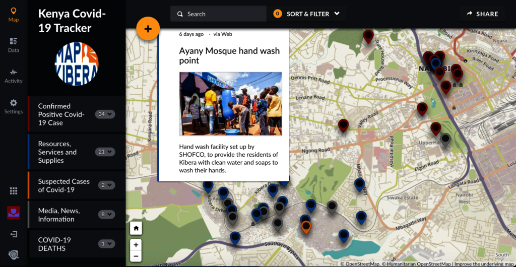
As cases of coronavirus mount in Kenya, Map Kibera has launched the Kenya Covid-19 Tracker Ushahidi instance in order to track cases in the country and resources available, especially in the slum areas of Nairobi such as Kibera.
Map Kibera began in 2009, when Kibera youth mapped their own community online for the first time using OpenStreetMap. Since then they have worked to create information resources and map social infrastructure in Kibera, a dense slum of over 200,000 residents, as well as several other slums of Nairobi and other parts of Kenya. The Kibera News Network (KNN), is Map Kibera’s online media channel covering Kibera news from a local perspective.
Map Kibera and the KNN team are currently mapping new Covid-19 cases every day, and the work that organizations and individuals throughout the country are doing to try to help during this outbreak. These activities include distributing food and face masks, setting up handwashing stations, sharing information about the virus and how to stay healthy, and more. Initiative leaders can also submit their own posts about what they are doing. Map Kibera is additionally mapping news items related to the virus, like articles from major new sources and tweets and social media. We are verifying all posts.

Our goal is to keep this information together in one easy place, allowing people to see what is going on around them that might be relevant to them. It is also to aid in our efforts to keep Kibera, one of the most vulnerable communities to illness, healthy during this pandemic. KNN is covering the impact of the virus on Kibera, people’s thoughts and concerns, addressing rumors and sharing accurate, relevant information in various ways including WhatsApp, Twitter, Instagram and Facebook.
We are using Ushahidi in part simply to document the crisis itself, and to create a geospatial information resource about what is happening where in Kenya for anyone to use. We also want organizations to use the map to share their own work with their constituents. Several Kenyan organizations are already sharing the resource and updating their own work in the map.
Our initial findings indicate that several organizations have taken measures to help communities tackle the issue of Coronavirus. Handwashing points that we mapped out seem to be fairly evenly distributed in Kibera; meaning at least a good number of people are able to access them. Organizations that previously did other work have re-tooled to better serve the community in this season; for instance Uweza in Kibera has been making masks for giving away, and the Polycom Development Trust makes sanitary pads for girls and is providing soap. Some of these efforts have been highlighted in the video here.
Regarding mapping of the spread of coronavirus in the country, we have also learned that tracking the government figures announced in their daily briefings can be difficult especially in terms of counties and more accurately localities within them. The map allows better visualization of the spread over time, to see how and where infections are being confirmed.
Over time, we envision, for this deployment, a one-stop geographically visualised spot for all covid-19 related information not just in slums but all of Kenya from varied sources such as the media, initiative leaders, national and county governments as well as individuals. This would hopefully provide accurate locations of infections, enable the provision resources where they are needed and prevent the duplication of efforts.
We invite your participation by donating here, and being a part of the efforts showcased in our Covid-19 Incidence and Resource Mapping in Kenya by submitting reports in.